View your GPS data overlaid on topographic maps in Google Earth
With this new feature of Wikiloc, you can view your GPS tracks and waypoints overlaid on topographic maps and aerial image layers in Google Earth.
A sample screenshot follows, but if you want to check it out live:
1- Open http://www.wikiloc.com
2- Find a trail or waypoint of your interest (or take this one from Scott or hikerdave's) and click on "More Maps" from the upper-right section of the map. Choose the map server you like from the list.
3- Now simply click on "3D View" next to the "More Maps" button to view that scene with the same base map/imagery but this time in 3D with Google Earth.
The sample below shows a mountain bike ride on 1:50000 topographic maps from ICC (using EPSG:23031):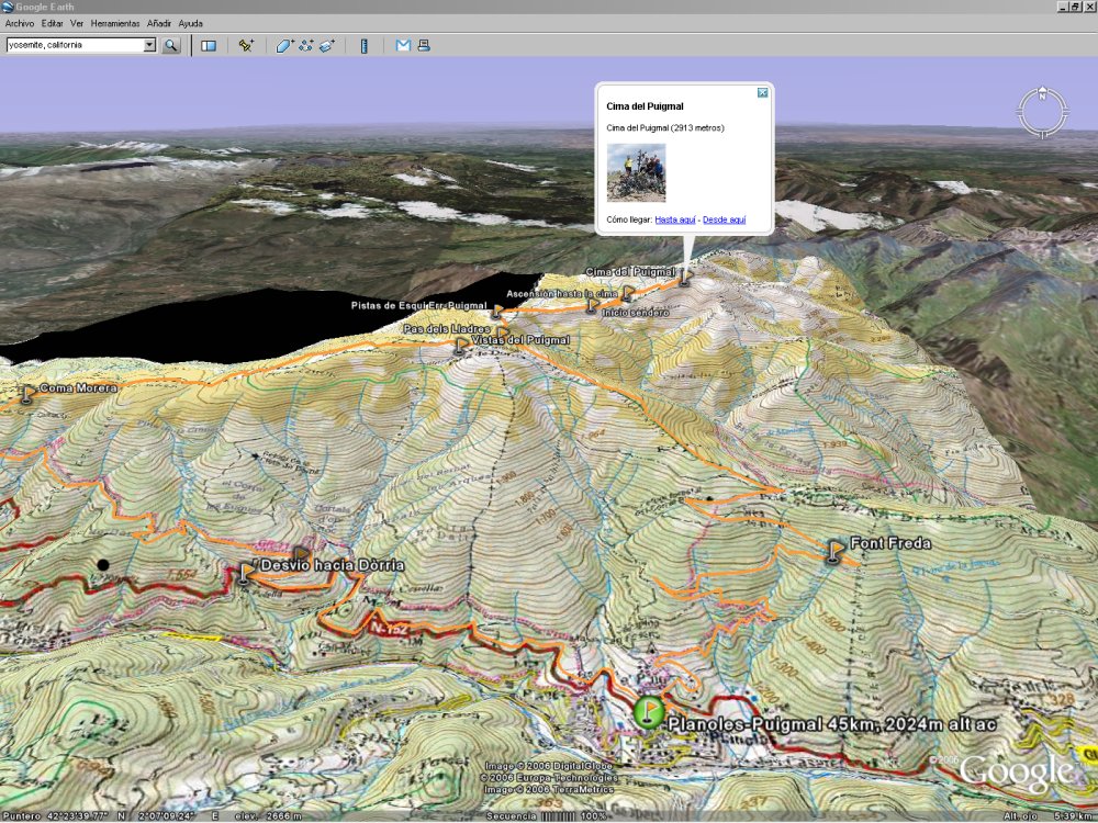
In this previous post I wrote about how you can visualize your GPS tracks and waypoints on USGS topographic maps (in 2D with Google Maps). From now on the base map you're visualizing in Wikiloc (2D) will be rendered too in Google Earth when you open the 3D view.
Btw: you can control the transparency degree of these layers with the slider that appears on the sidebar of Google Earth:![]()
 Add to del.icio.us
![]()


5 comments:
That is really neat! I noticed it seems to choose the 1:100K zoom level with the topo maps in GoogleEarth. Is there any trick to get the overlay to show the 1:24K maps (like you see as you zoom in with wikiloc)? Thanks!
At the moment the zoom level is in function of the trail extent. To get the USGS topo at 1:25000 for example there would be necessary to request a huge map from the USGS server, which could stress the server and I think they've limited (logically) to a maximum of 2000 pixels width.
Most of the time I've spent with this feature it's been dealing with coordinate reference systems and datums (e.g: overlaying correctly in Google Earth imagery from map servers that only work with EPSG:23031).
I definitely have to figure out how to do what you suggest. I don't know if it's possible to dynamically update part of an overlay in Google Earth when zooming in to a small area.
That would be great since as you point out, with multiple zoom levels we'll enjoy much more detail from the USGS servers.
Thanks for the feedback, I'll let you know if I make progress on this issue.
Hi Scotte:
I'm glad to inform you that the issue with the fixed 'zoom level' with the topo maps in Google Earth is already fixed :) From now on the overlays are incrementally refreshed to a better detail as you zoom in. Thanks for pointing out the issue.
Nice blog.Very informative and i will keep visiting this blog.
pdaaccessories.com
Hi guys! Here's a free conversion tool you can use when making gpx to kml files and vice versa. http://gpx2kml.com/ is a reliable software program, free and simple to use, no installation required.
Post a Comment