Saturday, July 29, 2006

Help

During the development of Wikiloc (still ongoing) I've repeated some actions so many times that I eventually forgot that the first time I did those activities they were not so intuitive and easy to do.

I've received some emails from Wikiloc users asking for help. I've answered those emails the best I could but they've made me reconsider that some online help was needed. I've written a short document answering the most demanding questions, so check it out and let me know if you think there's something left. You can open the help page from the top right section in Wikiloc:


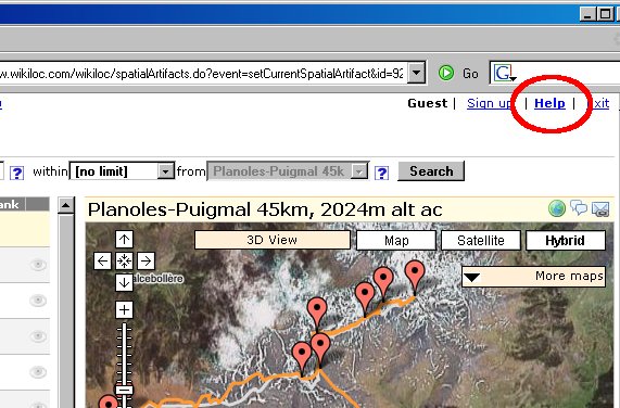
Or directly in this link.

Monday, July 24, 2006

Some improvements

From now on you can control the zoom level by double-clicking on the map (use the left button to zoom-in and the right button to zoom out).

Additionally I've made some improvements in the 3D view using Google Earth. You can see the images of locations and the elevation profile for tracks. I've changed the icons that represent waypoints and tracks too.

As always, I'd be glad to hear your opinion on this.

Tuesday, July 04, 2006

View your GPS locations in 3D

I've just added a button that generates a KML file (the Google Earth file format) of the location(s) that you're viewing on Wikiloc's map view. If you have Google Earth installed in your computer, you can open the downloaded file to view and 'fly around' the locations in 3D.


If the quality and detail of Google Earth's base imagery for the zone you're viewing is good, the results are pretty cool: