View your GPS locations in 3D
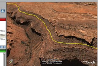
I've just added a button that generates a KML file (the Google Earth file format) of the location(s) that you're viewing on Wikiloc's map view. If you have Google Earth installed in your computer, you can open the downloaded file to view and 'fly around' the locations in 3D.
If the quality and detail of Google Earth's base imagery for the zone you're viewing is good, the results are pretty cool:


No comments:
Post a Comment