Some samples:
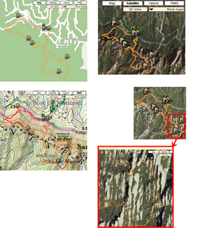
The following images taken from Wikiloc show views of the same GPS track over different base imagery and maps. From left to right, top to bottom: Google's Map view, Satellite view (the zone doesn't have much detail by now), ICC's 1:50000 WMS topographic map and the last two pics show the detail that can be reached using the ICC's 1:5000 accurate orthoimagery (it's been taken from a plane instead of a satellite):

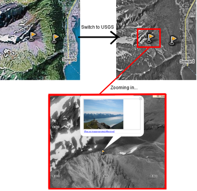
And another sample: the following snapshots show some waypoints taken in the way up to Mount Marathon (Seward, Alaska). In this geographic location we can use USGS imagery:

I'm personally glad of this feature since viewing my GPS tracks over multiple base maps was one of the motivations that drove me to develop Wikiloc. By then I couldn't imagine that I'll be viewing them -easily- in 3D as well. :) Hope it'll be useful for you too!
No comments:
Post a Comment